Posted in History, Scenery, Seaside Scenes, Trips at 12:00 on 21 January 2023
Wideford Hill Chambered Cairn, Orkney was one of the ancient sites in the Orkney Islands we didn’t visit in 2017. We tyook it in in June last year.
The approach is up a very steep – and winding – farm road till you reach the car park (grandiose description for two parking spaces) from which you can look down to Kirkwall. The photo also shows some of the road:-

There is a view of Scapa Flow from there too:-

A notice at the car park said the chambered cairn was about half a mile away on a path round the hill. It was much longer than that.
You can see me walking the path here in a photo taken by the good lady. As you can see the cairn is nowhere in sight and we had been walking for about twenty minutes by this time:-

Cairn from path. To the left you can see the box in which the key to the entrance is kept and the information board:-

Information board:-

Original entrance (now gridded off):-

Cairn from above. The modern entrance is the blue square on its top

No Comments »
Posted in Bridges, Scenery at 21:00 on 28 August 2022
In March we were wandering down the Back Burn quite near to our house and I spotted a small bridge which I had previously never noticed. Mind you it was almost totally concealed by greenery and in summer it will be much more so.

View of burn from bridge:-

Other side of bridge:-

A bit downstream there is this sluice gate which I may have posted before (but it’s not evident on a quick search):-

No Comments »
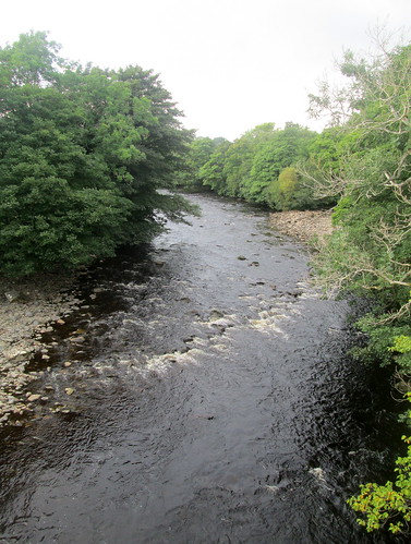
Posted in Architecture, Scenery, Trips at 12:00 on 9 April 2022
Middleton-in-Teesdale is a market town in ….. Teesdale, County Durham, England.
As its name suggests it stands by the River Tees.
This bridge over the Tees is on the east/south approach to the town:-

River looking east from the bridge:-

Looking west:-
This Coop in the town has deco touches. (Stitch of two photos. The buildi ng isn’t really curved):-

No Comments »
Posted in Bridges, Scenery at 12:00 on 2 February 2022
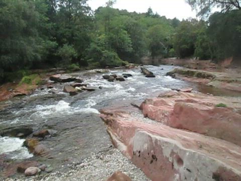
From Edzell Castle (posts passim) we took a stroll along the road to the old motte and bailey and A graveyard which contained the historic graves of the Lindsay family. Just further along there was a car parki and on investigation we saw a signpost to Pirner Brig. This turned out to be a walk alongside a river which we later discovered is the River Westwater.
Before doing that we descended a fairly steep set of stairs to the river itself, which is very scenic.
River and Pirner Brig:-

River and rocks:-


We then reascended the steps and took the path which crosses the brig.
River from Pirner’s Brig:-

I took a couple of videos
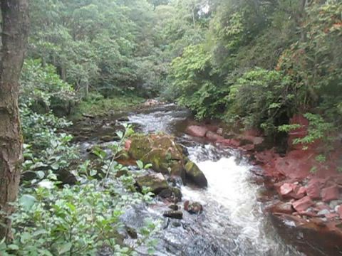
This is a lovely spot, and more or less unspoiled.
No Comments »
Posted in Fife, Scenery at 12:00 on 22 August 2021
The Back Burn, see here and here, runs through the old Balbirnie estate and on past Markinch.
Just near where we live it passes through a declivity. The burn isn’t easily spotted in this photo:-

It’s just to the bottom at the right here:-
It flows over some rocks about halfway along:-

There are some flatter stretches too:-


Then it forms a barrier cutting off the golf course’s 18th fairway from the green.
Further on, looking back from beyond the golf course’s car park, you can see a second old bridge across the burn which was not undermined in the floods I mentioned here.

Another cascade:-

Flowers by the burn’s side:-

Trees by burn side:-

You can see the bridle path crossing in this one:-

No Comments »
Posted in Bridges, Fife, Scenery, Weather at 12:00 on 17 August 2021
Last August I noted floods at Balbirnie Golf Course. The bridge featured in that post was sunsequently removed probably because its supports had been undermined.
In April this year I photographed the foundations of a replacement bridge.


The golf course itself was looking fine.
18th fairway and green:-

The 10th tee had some striking shadows:-
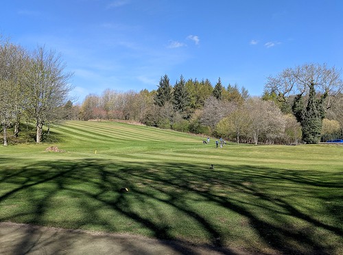
10th tee and 18th fairway:-

1 Comment »
Posted in Fife, Scenery at 12:00 on 11 August 2021
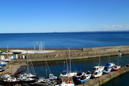
I have posted photos of Dysart harbour before.
The harbour from the edge of Ravenscraig Park in April 2021.
The main building is the former Harbour Master’s house. St Serf’s Tower and the red-tiled roofs of the white painted houses of Pan Ha’ lie behind.

Dysart Harbour looking over to North Berwick Law and the Bass Rock:-
2 Comments »
Posted in Bridges, Fife, Scenery at 12:00 on 22 April 2021
Last August there was severe flooding in Balbirnie Park. The Back Burn even overflowed by Balbirnie Golf Club’s eighteenth green, probably due to that tree trunk stuck at the bridge. Part of the revetments had been washed away:-


Between Golf Club’s clubhouse and Balbirnie House Hotel the road was flooded:-
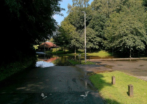
The area just at Balbirnie House (and Hotel) which had flooded in February 2020 did so again:-


No Comments »
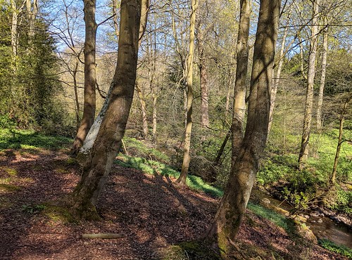
Posted in Scenery at 12:00 on 18 April 2021
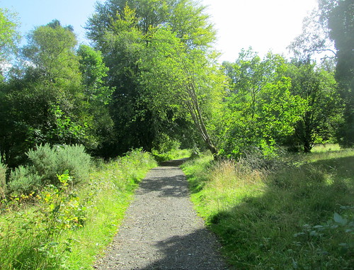
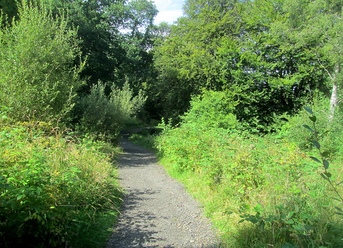
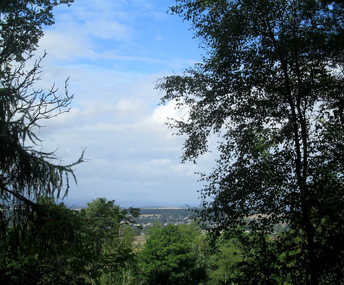
Despite it being relatively near we had never been up Kinnoull Hill near Perth till one fine day in August last year.
It’s a lovely wooded walk up to the top.
Path to summit:-
We could see the town of Scone (pronounced Scoon) through a gap in the trees:-
At the top there’s a good view of the “silvery” River Tay as it meanders eastwards:-
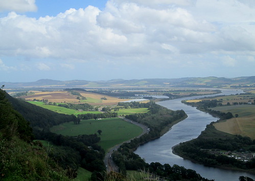
This is a stitch of three photos showing the river as it flows from Perth (on the right) under the Friarton Bridge then on towards Dundee.

This is another stitch showing Perth itself:-

This one is looking north towards Dunkeld and Birnam:-

No Comments »
Posted in Curiosities, Scenery at 12:00 on 14 April 2021
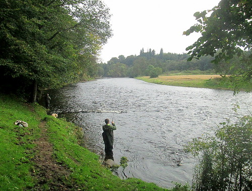
Doune Castle (see previous post) is built on a promontory just above the River Teith. The river’s banks are pretty overgrown now so it’s not easy to see the river till you get quite close to it.


It must be fine for fishing though as there was an angler there the day we visited:-
The Teith flows on to join with the River Forth just upstream of Stirling. Curiously, the Teith is the wider river at this point but the merged river is called the Forth.
No Comments »
