Archives » History


Clava Cairns (i)
Posted in History, Trips at 12:00 on 4 June 2026
Clava Cairns is a site near Inverness containing the quite well preserved remains of prehistoric structures used for burials. It’s also very close to the Culloden battle site.
General view from entrance:-


Looking back from inside site:-


Cairn (with entrance hidden by standing stone above):-

Interior of cairn:-

Cup and ring marks:-

Soldier’s Leap at Killiecrankie
Posted in History, Trips at 12:00 on 6 May 2026
In the first Jacobite Rebellion (in 1689) a battle took place at the Pass of Killiecrankie.
I had always meant to visit the site but somehow never had until April last year, despite it being only three miles from Pitlochry which we have visited many times.
The Pass is a very tight space between two steep hills on either side of the River Garry. Not an obvious spot for a battle.
The government forces were advancing from the south to remove the Jacobite presence from Blair Castle just to the north and were attacked from the hills by the Jacobites under the command of John Graham of Claverhouse (aka ‘Bonnie Dundee’) scourge of the Covenanters by whom he was later dubbed ‘Bluidy Clavers’.
Such was the lack of space in the Pass the government troops could only line up three deep, firing up the hill.
The Jacobites were victorious but Dundee was killed by a musket ball. With his death the Jacobites lost their militarily talented leader and the rebellion petered out soon after.
In the government soldiers’ retreat one of them was forced to make a desperate jump acros the river to escape capture (or worse.) A path leads down from the Killiecrankie Visitor Centre to the site of the leap.
Soldier’s Leap:-

Video:-
Len Deighton
Posted in Events dear boy. Events, History at 12:00 on 18 March 2026
The once prolific writer Len Deighton – whose surname I share (apart from its pronunciation: he rhymed it with Dayton, my family rhymes it with Brighton) – has died: at 97, a good innings by any standard.
Back in my youth I was a keen reader of his spy fiction – he and John Le Carré were the two preeminent spy writers of the time – but it was his Bernard Samson stories, the Game, Set and Match; Hook, Line and Sinker and Faith, Hope and Charity trilogies and their prequel, Winter, which I consumed most avidly.
Then there were his forays into Altered History, SS-GB and XPD, which I greatly enjoyed.
His interest in the Second World War was explored further in the novels Bomber and Goodbye Mickey Mouse, both excellent, before he embarked on History proper with the books Fighter: The True Story of the Battle of Britain; Blitzkrieg: From the Rise of Hitler to the Fall of Dunkirk; the lavishly photographically illustrated Battle of Britain, an interest consummated by the much later review of that war in its entirety in Blood Tears and Folly.
Of these latter I only read one during my blogging years.
Leonard Cyril (Len) Deighton: 18/2/1929 – 15/3/2026. So it goes.
Holy Trinity Church, St Andrews
Posted in Architecture, History at 12:00 on 17 February 2026
Holy Trinity Church is in the centre of St Andrews, in what is a kind of town square, two sides of which are pedestrianised. It is the traditional Parish Church for the town and was where John Knox helped to start the Scottish Reformation.
For some reason it was open when we were in the town in September 2024 so we took the chance to have a look around.
East window:-

Door and west window:

The pulpit is fairly elaborate and lit up from within:-


The wooden ceiling is also worth a look, containing several armorial crests:-

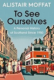
To See Ourselves by Alistair Moffat
Posted in History, Scotland at 12:00 on 22 November 2025
A Personal History of Scotland Since 1950. Viking, 2025, 270 p, including 3 p Foreword, 16 p Index, 2 p Further Reading and 1 p Acknowledgements.
As the title suggests this is a History of Scotland over the past 75 years as seen through the author’s eyes. He was brought up in Kelso, firstly in what he says people dismissively called a prefab, then a council house, in a time before the rise of supermarkets, when the food was local, without a hint of air miles, and goods were dispensed from larger containers into smaller carriable ones by the shop assistant (in my experience this was usually a man.) At the time most houses did not have a fridge – never mind a freezer – so food was consumed more or less on the day it was bought, necessitating many visits to the shops each week. Moffat waxes most nostalgic about the milk from the local farmer, rich and creamy or richer and creamier – no skimmed milk back then – but that food products from the Empire were unremarked on, taken as read, as was Imperial paraphernalia such as the label on Camp Coffee bottles. He also remembers, as do I, that Christmas was a working day in Scotland until very late in the 1950s.
His father was of the generation that knew its place and still suffered from deference to the landed classes (the Duke of Roxburghe’s Floors Castle lies just outside Kelso.) When Moffat’s elder sister performed well enough in school to get to University her dad at first was against it but his wife prevailed on him so off the sister went and in due course Moffat followed. Corporal punishment by the tawse was an everyday feature of Scottish schools at that point and Moffat outlines the circumstances that led to its abandonment.
The mid-1960s expansion of university places and the provision of grants made working class attendance at University eminently affordable for Moffat’s contemporaries and he laments the present system whereby, notwithstanding the provision for tuition fees, Scottish students now rack up huge debts while gaining a degree. He is also of the opinion that student life ought to be about more than educational attainment rather than narrowed down to academic performance.
The coming of television altered daily life as did the advent of The Beatles, the sexual revolution, and the Abortion Bill sponsored by Moffat’s local MP, David Steel.
Agriculture too has changed, the coming of the little grey Fergie tractor with its device for transferring power to farm implements hastening the demise of the horse and the jobs that they necessitated, grooming, smithing etc.
The decline of church-going has been precipitate (apparently now attendance at Catholic services outstrips the Church of Scotland, a fact which would have astonished those formidable eighteenth and nineteenth century adherents of the Scottish Reformation.) He touches on the religious divide which still mars life in Scotland. Apparently in staunchly Protestant Larkhall the lowest traffic light of a set was smashed on a routine basis, ASDA was even discouraged from opening there due to its green livery.
Newspaper readership was once much higher in Scotland than in the rest of the UK, the Saturday evening ‘pinks’ a feature, and Sundays were dominated by the Sunday Post, adorned by its pullout “Fun Section” – The Broons, Oor Wullie and all, and its border editions covered rugby extensively.
Moffat tells us that the Sunday Post was a true newspaper, with broad coverage of foreign news. “Couthy, borderline obsessive about Scottish sports reporting and constantly upholding what might be seen as the values of the Kirk – the Sunday Post was all of those things. But parochial it was not.” He then adds the killer line, “The paper even covered events in England.”
He remarks on the liberation of the licensing laws – which has not led to the deterioration of behaviour its critics feared and predicted but, he says, to a more measured approach to alcohol consumption – and laments the decline in amateur sport.
He notes the transformation of women’s place in society, and the highlighting of domestic abuse which had once tended to be considered a private matter but is now treated more seriously.
His final chapter is titled Permacrisis and deals with the upheavals, political and otherwise, which the world has seen over the past decade.
As a summary of the Scots experience in the past seventy years To See Ourselves is an excellent primer.
Pedant’s corner:- Wilfred Brambell (Wilfrid Brambell,) the Glasgow Evening Times’ editorial (Glasgow Evening Times’s,) “Robbins’ expansion” (Robbins’s,) the Hawkins’ house ( Hawkins’s,) the Flower Pot Men (the Flowerpot Men,) I Love Lucy is implied to have been aired on STV (I remember it as being on the BBC,) “Captain W E John’s Biggles” (Captain W E Johns’s,) “each Autumn Scottish schoolchildren were allowed off school for the ‘tattie holidays’” (not in all Scotland, certainly schools in Dumbarton didn’t have that break, though an October week or two is now, I think, standard across Scotland,) spikey (spiky,) “more liberal that in England or Wales” (more liberal than,) “the orchestra reached a crescendo” (crescendos are not reached; they build,) “the Lionesses won the European Champions Cup” (actually the European Women’s Championship; the Champions Cup is for clubs,) “a Scottish businesswomen” (businesswoman,) “Liz Truss’ childish petulance” (Truss’s – as it was on the next page,) “seem not be episodes” (seem not to be episodes,) “Nana Hawkins’ house” (Hawkins’s.)
The Maiden Stone
Posted in History, Trips at 12:00 on 26 July 2025
Another Pictish symbol stone, this one by the side of a minor road just northwest of Inverurie, Aberdeenshire:-


Information board:-

Brandsbutt Symbol Stone, Inverurie
Posted in History at 14:00 on 22 July 2025
This stone is now in the middle of a housing estate in Inverurie, Aberdeenshire. It was once part of a stone circle.

Stone’s markings:-

Information Board :-

St Machar’s Cathedral, Aberdeen (i)
Posted in Aberdeen, Architecture, History at 12:00 on 14 July 2025
St Machar’s Cathedral in Aberdeen has not had a bishop since 1690, so it is now technically a high kirk. It is used as a parish church by the Church of Scotland.
Spires:-

From entrance gate:-

From sides:-


Rear of kirk:-

Grave of William the Lion, Arbroath Abbey
Posted in History, Scotland at 12:00 on 8 July 2025
We had meant to visit Arbroath Abbey for some time but did not actually do so till last year. (We had tried the year before but the Abbey was undergoing some restoration work so access was limited and we decided against it.)
William the Lion was the longest reigning king of Scotland before the 1603 Union of the Crowns. He was the first Scottish king to arrange an alliance with France. His epithet ‘the lion’ did not relate to military prowess but rather to his banner the red lion rampant on a yellow background, still the banner of Scottish monarchs though frequently used as a symbol of Scotland itself and often brandished at sporting events.
Domestically his reign saw legal and local government reforms but disputes with English kings and his attempts to regain the Kingdom of Northumbria were not so successful.
William is credited with founding the Abbey at Arbroath, so to find his grave there is not surprising.

