Posted in Architecture, Bridges, History, Trips at 12:00 on 1 December 2021
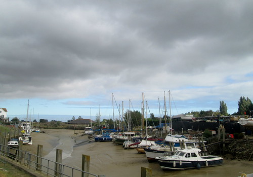
The main body of Chesters Fort lies on a hill just above the river River North Tyne.
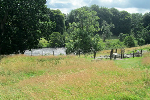
River from Chesters Fort:-

This shows the spot where a Roman bridge crossed the river:-
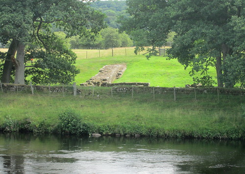
Eastern part of Hadrian’s Wall and bridge abutment:-

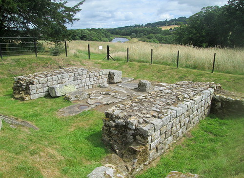
Closer view:-
Bridge information board showing how it looked:-

Between the bridge and the fort proper you can still see a part of Hadrian’s wall:-

Also down by the river are the baths the soldiers used:-

Lower part of baths complex:-
1 Comment »
Posted in Trips at 12:00 on 10 November 2020
Our furthest flung destination in September last year was Rye in East Sussex. The good lady had always wanted to visit as she is a keen fan of E F Benson’s Mapp and Lucia books and they were set in Rye where Benson lived for a long time. He in fact became mayor of the town.
Benson called his fictional town Tilling, naming it after the (very tidal) River Tillingham which flows through the town and on whose banks our hotel stood.
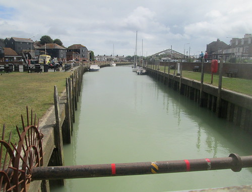


River Tillingham (and River Haven Hotel, the main building over the river):-

Bellwatch Lane, Rye. I believe this bell was set up here to warn of French invaders:-

No Comments »
Posted in Architecture, Art Deco at 20:30 on 23 June 2020
The Turk’s Head, Tynemouth, has Art Deco styling:-

I couldn’t go to Tynemouth and not have a look at the River Tyne’s mouth.
Mouth of River Tyne with North Sea beyond:-

No Comments »
Posted in Bridges at 12:00 on 7 July 2019
Inverbervie, in Aberdeenshire, has two bridges spanning the River Bervie.
New bridge and old bridge. Old bridge to right and below:-

New bridge from start of old bridge:-

Panorama of new bridge from old bridge. The stitch doesn’t quite show the bridge’s bend:-

Old bridge from road. New bridge behind to left:-

Old bridge from new bridge:-

No Comments »
Posted in Bridges at 20:00 on 30 June 2019
Son of the Rock Acres backs on to a former estate whose ‘big house’ has been turned into a hotel. There are extensive woodland walks round the place even though most of it has long since been converted into a golf course. A burn, the Back Burn, flows through it and on through the town of Markinch before eventually joining the river Leven.
I’ve just realised I’ve not really posted any pictures from the estate mainly because the good lady tends to use them.
Anyway, not far away – about three miles – at the edge of the village of Falkland, lies another estate through which runs another burn, which possibly itself feeds into the Back Burn. A signpost at the bottom of the path points to Maspin Glen.
This is that burn:-

And this is a bridge over it carrying one of the estate’s paths:-

No Comments »
Posted in Trips, Wild Life at 12:00 on 24 January 2019
We stopped at Ellon both on the way up to Peterhead and on the way back down.
A scenic river passes just to the west of the town, the River Ythan.

It’s crossed by two bridges, the old one:-

And the newer:-

If you look closely at the above photo you’ll spot a single swan. Here it is in a closer shot:-

No Comments »
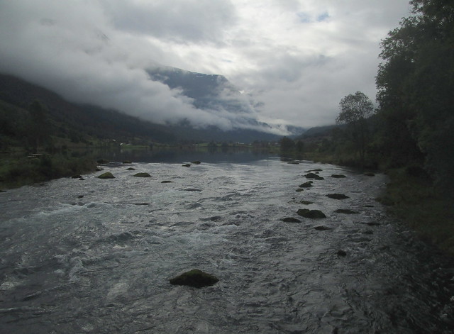
Posted in Norway Cruise, Trips at 20:00 on 10 October 2018
Looking up to Lake Floen from falls on Oldeelva river:-
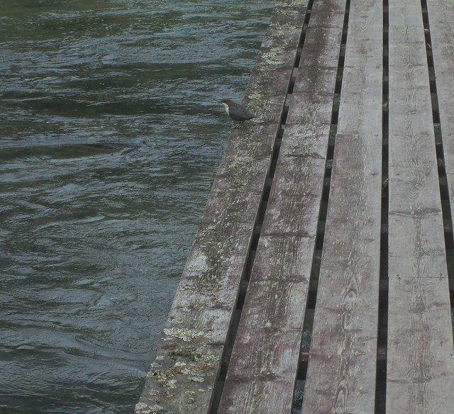
On the way back to Olden village we decided not to take the road again but to walk the path on the other side of the river.
This required walking across wooden catwalks/bridges. You can see other such walkways in photos in previous posts:-

One of them had this small bird (a dipper?) perched on it
Looking back towards the falls:-

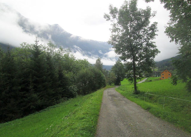
There was a path of sorts – more suitable for bikes really – but eventually after having to cross some grass we hit on a semi-metalled road. This was the view back up towards the lake:-
No Comments »
Posted in Architecture, Art Deco, Bridges, Trips at 20:00 on 26 August 2018
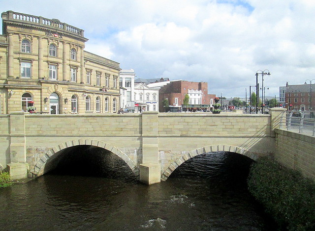
Until recently the River Roch through Rochdale town centre had been covered over for decades – almost a century. It’s been opened up now and the river looks well. A town always seems better for a river running through it.
Bridge in Rochdale town centre, Art Deco former Regal Cinema, now The Regal Moon, in background:-
Bridge in Rochdale town centre from opposite side, Town Hall in background:-
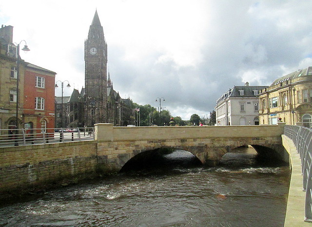
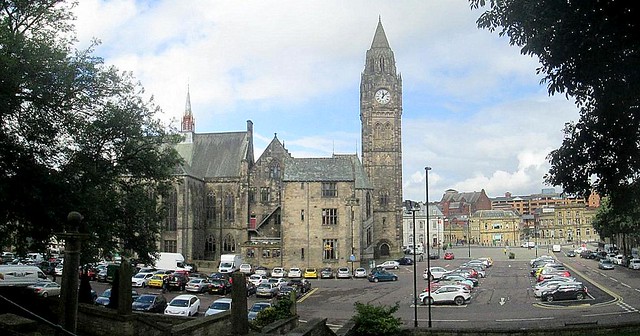
Rochdale Town Hall and Square:-
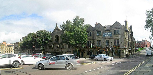
One side of Rochdale Town Square (to the right in previous picture):-
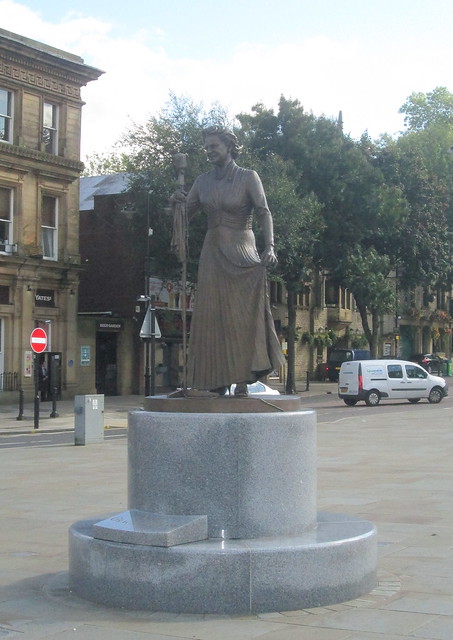
Rochdale’s most famous daughter is perhaps, Gracie Fields. There is a statue of her, complete with old style microphone, in the town square:-
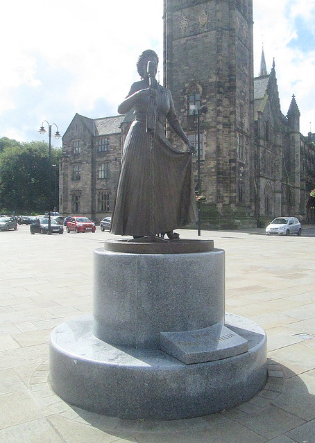
Different angle. Town Hall in background:-
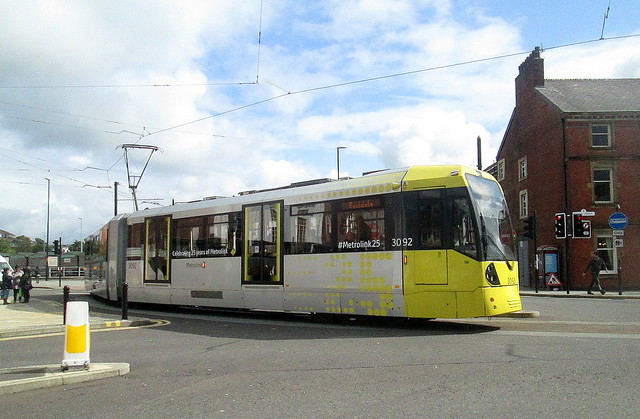
The Rochdale trams are colourful; well, bright:-
No Comments »
Posted in Bridges, Trips, War Memorials at 12:00 on 7 March 2018
The village of Kenmore lies at the foot of Loch Tay in Perthsire.
Main street left. Taymouth Castle gates are behind you in this view. You can just make out the War Memorial at the far end of the street in front of the kirk:-

Main street right:-

Main street reverse view. Gates of Taymouth Castle middle centre. The War Memorial is directly behind here:-

Looking down to foot of Loch Tay:-

Foot of Loch Tay:-

Near Kenmore a reconstructed crannog has been built out onto Loch Tay. This is the view of Kenmore from there:-

The outflow from Loch Tay is the start of Scotland’s longest river, the silvery Tay. This lovely bridge spans it:-

River Tay at Kenmore:-

No Comments »
Posted in Trips at 12:00 on 12 February 2018
These photos were all taken on the hoof through the car window.
Not by the driver I hasten to add.
Skye’s landscape is pretty bleak with very few trees but has a stark beauty of a kind.
The main mountain range is the Cuillin but the Black Cuillin lie more to the west of the island than these which I believe belong to the Red Cuillin.


No Comments »
