Posted in History, Trips at 20:00 on 15 March 2018
When we visited here we thought it would be a short visit but they put on a talk describing neolithic life and giving demonstrations of various sorts including making fire so we ended up taking nearly two hours. Not the least of the interesting titbits was that apparently midges don’t come out over the water. Those neolithic folk weren’t daft!
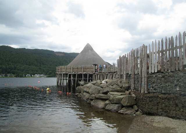
Reconstructed crannog entrance:-

Crannog walkway, right:-

Crannog walkway, left:-

Reconstructed crannog from lochside:-
It’s surprisingly spacious inside. Interior panorama:-

Hearth:-

Roof centre:-

No Comments »
Posted in History, Trips at 20:05 on 13 March 2018
A crannog is an artificial island (or the remains of one) usually built out onto a loch (but sometimes a river or estuary) and dating from Neolithic times.
At The Scottish Crannog Centre, which lies on the western shores of Loch Tay not far from Kenmore, it says there are at least seventeen remnants of crannogs on Loch Tay alone.
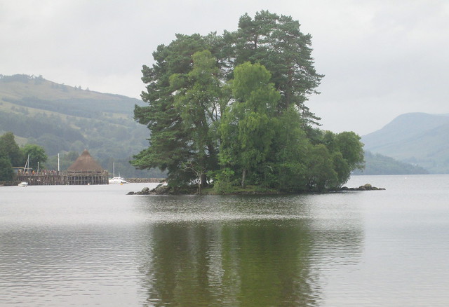
In this photo, taken from the foot of Loch Tay at Kenmore, you can see the wooded remains of a crannog in the middle of the loch to the left and (just about) the recontructed crannog at the Crannog Centre to its right:-
Here’s a closer view, reconstructed crannog off to right:-

Closer still:-

A different angle:-
The reconstructed crannog:-

Another, larger, crannog on the opposite shores of Loch Tay taken from the location of the reconstructed one:-
No Comments »
Posted in History, Trips at 20:00 on 23 July 2017
After settling in at Stromness for the night, the neolithic village of Skara Brae, on the shores of Skaill Bay (or Bay o’ Skaill,) was the first place we visited on Orkney. Ever since I heard about it Skara Brae was somewhere I always wanted to visit so I was delighted to be able to.
It was mobbed with people though, only to be expected I suppose.
Early houses:-


Passage to a house entrance:-

An excavated house, Skara Brae Visitor Centre in left background, modern day Skaill House in right background:-

Neolithic house with stone dresser:-

Neolithic house entrance:-

A passage between houses:-

No Comments »
Posted in BBC, History, Trips at 12:00 on 15 July 2017
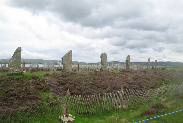
“The Ring of Brodgar is the finest known truly circular late Neolithic or early Bronze Age stone ring and a later expression of the spirit which gave rise to Maeshowe, Stenness and Skara Brae.”
Earlier this year a BBC TV series called Britain’s Ancient Capital: Secrets of Orkney fronted by Neil Oliver argued convincingly that Orkney was an extremely important cultural centre in neolithic times and that the construction of stone circles originated in Orkney, spreading south from there – eventually to produce Stonehenge.
Unfortunately the path directly round the outside of the Ring was undergoing maintenance when we visited so it was not showing its best appearance. And as you can see we were not the only visitors:-
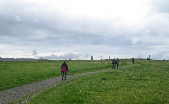
I did try to get a photo without other people in it:-
Ring of Brodgar from perimeter:-
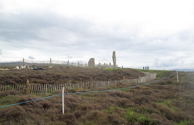
You’re absolutely tripping over ancient man-made structures in the Stenness area. This mound, by the shores of the Loch of Stenness and not far from the Ring (from where this photo was taken) is called Salt Knowe. The hills in the background are on Hoy:-

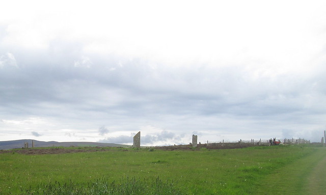
Ring from perimeter path, Loch of Harray in the background:-
Single stone, with man to show scale, part of Loch of Harray behind. You can easily see wear to the grass around the stone, emphasising the need for maintenance:-
Looking Towards Ness of Brodgar and Maeshowe from Ring of Brodgar. Loch of Harray to left of Ness of Brodgar, Loch of Stenness to right, Maeshowe just to left of middle of photo:-
No Comments »
Posted in History, Trips at 12:00 on 5 July 2017
This is what the information board named as structure 8. Looking back towards Stones of Stenness with Hoy in distance to right:-

A neolithic house overlooking Loch of Harray:-

House 6 has very little left bar a few stones:-

Whether this is a standing stone or a remnant of a house I can’t say. Its surroundings don’t seem to have been excavated. Bottom of Loch of Harray behind with Maeshowe in distance above top of stone:-

View of Barnhouse Village looking south-west, Stones of Stenness in background with Hoy in right distance:-

Stitch of village from south-west. Loch of Harray and Ness of Brodgar behind:-

No Comments »
Posted in History, Trips at 12:00 on 1 July 2017
The piece of land on which the Stones of Stenness lie contains other neolithic remnants.
One is the Watchstone (which used to have a companion Odin Stone which was destroyed in 1814 by the leaseholder of the land.)
The Watchstone from path round Stones of Stenness, Ness of Brodgar behind:-

The Watchstone and Ness of Brodgar, Loch of Stenness to left, Loch of Harray to right:-

The Watchstone, looking over the Loch of Stenness, Hoy in distance:-

Two hundred yards or so north east of the Stones of Stenness are the remains of a neolithic settlement called Barnhouse Village – of which more later. This photo taken from the edge of the village over the bottom of the Loch of Harray shows how close Maeshowe is (green mound just to right of centre of picture.)

Looking northwest over the Loch of Harray from Barnhouse Village you can also easily see the Ring of Brodgar:-

Closer view of Ring of Brodgar from Barnhouse Village:-

No Comments »
Posted in History, Trips at 15:00 on 29 June 2017
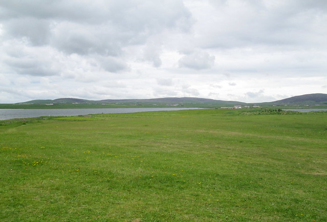
A view of part of Orkney for your delectation.
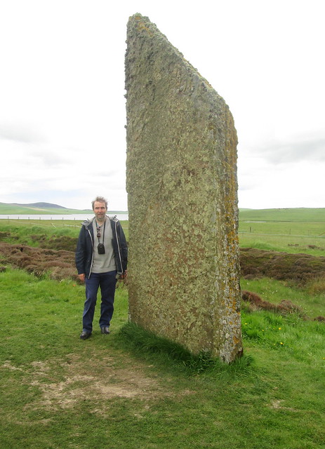
The Stones of Stenness are the remains of a ring of neolithic standing stones – possibly the oldest henge in the British Isles. They stand on a piece of land flanked on one side by the freshwater Loch of Harray and the sea water Loch of Stenness.

The taller ones are very tall indeed. I assume the ones no longer there were also as tall. Signs of modern life are visible though. You can just spot electricity poles if you look closely enough above.
Here’s a view from the other side of the stones back in the opposite direction. Note parked cars and people. Shortly after this a bus tour rolled up:-

What looks like a single stone to the left on the above is actually two stones:-

If you look through the gap in the stones in the other direction then Maeshowe is directly between them in the distance. See sixth photo here.
On the same piece of land as the stones lie the remains of the neolithic Barnhouse village. The Ring of Brodgar is also visible from the site.
At the centre of the Stones of Stenness are the remnants of a hearth:-

Stones of Stenness from site entrance. Unfortunately an electricity pole seems to sprout from the top of a stone in this one:-

No Comments »
