Posted in History, Trips at 12:00 on 12 December 2024
I had noticed that Avebury wasn’t far from the direct route back north from our trip to Bath etc so made sure to visit the site on the way back up.
We parked in the National Trust car park and walked to the Henge. I didn’t realise until after we returned and travelled on that it is the main road which actually cuts through the site.
Welcome Board :-

The site is extensive and consists of several stone circles and earthworks.
Stone circle from “avenue” into the site:-


Closer view of inner circle:-

Looking back to ‘avenue’ entrance:-

Showing part of Avebury village:-

‘Avenue’ from rampart:-

No Comments »
Posted in Architecture at 12:00 on 15 August 2024
Linlithgow in West Lothian is one of our favourite places. I could have sworn I had posted photos of the palace there, Linlithgow Palace, where Mary, Queen of Scots was born in 1542, but a search on the blog proved fruitless.
The Palace is approached from the town up a short road and is partly obscured by St Michael’s Church on your right as you do so. As a result there is not a good angle to view the Palace facade. It opens out a bit at the top.

The Palace – with St Michael’s Church (the tower with crossed beams) behind – is best viewed as a whole from across Linlithgow Loch:-

Side view from the grounds surrounding the Palace:-

The interior courtyard is dominated by an elaborate fountain:_

Fountain and east range. The Palace’s original entrance was on the east. The wall above taht enrtance would have been painted in bright colours:-

North range:-

No Comments »
Posted in History, Trips at 12:00 on 17 December 2023
Burghead stands on a promontory sticking out into the Moray Firth. We visited because we had read of the ancient chambered well there.
To visit the well requires picking up the key from the visitor centre. This, it transpired, was hard by the remains of a Pictish Fort though to be the oldest in Scotland. Apparently about half the Fort was destroyed when the town was built in the early 19th century.
Plaque by edge of Fort:-

Site of Fort. The Visitor Centre can be seen beyond. (It’s the white building.):-

No Comments »
Posted in Architecture, Trips at 12:00 on 10 December 2023
Duffus Castle is a few miles north of Elgin in Moray.
Castle from car park:-

From approach path:-

Information board:-

Castle interior:-


Castle from east:-

External wall (seen to left above):-

Wee bridge at end of path from Duffus Castle in photo two above:-

As we were walking back up the path towards the castle to go back to the car park we heard a tremendous roar. Two jet planes came flying over. This is one of them:-

1 Comment »
Posted in History, Trips at 12:00 on 6 November 2023
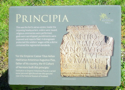
Principia:-
Commander’s Residence:-

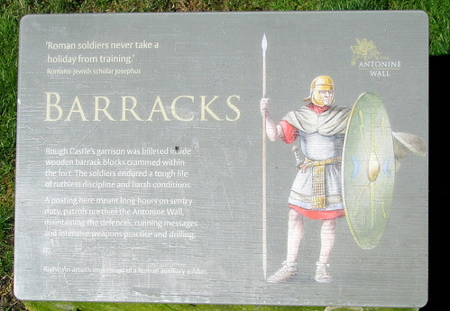
Barracks:-
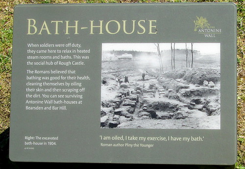
Bath-House:-
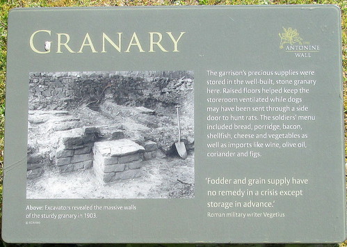
Granary:-
Annexe:-

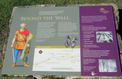
Beyond the Wall:-
No Comments »
Posted in History at 12:00 on 4 November 2023
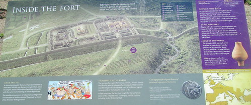
Just before we reached the Antonine Wall at the Falkirk Wheel we saw signs for Roughcastle Roman Fort so decided to follow the path. It took us a while and I was beginning to wonder if we wouldever get there but we did. Only the outlines of the fort still remain.
The Information Board shows what it would have looked like:-
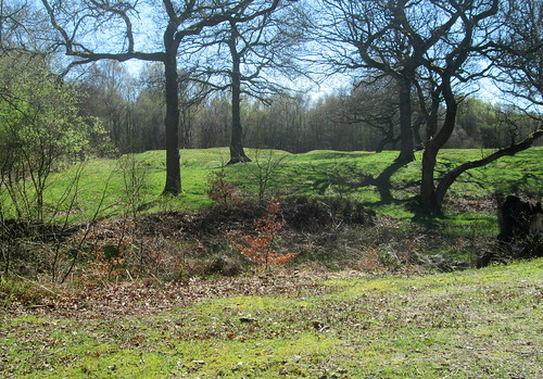
Fort (south of Antonine Wall):-

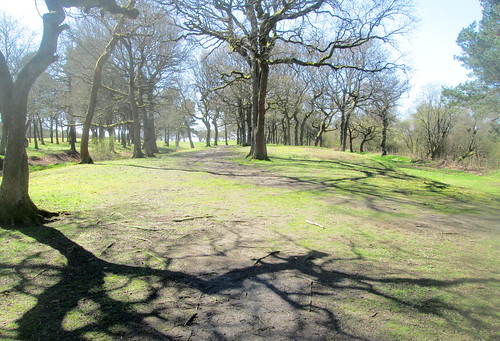
Wall before fort:-
Southern Gate:-

No Comments »
